SST Anomalies in April, 2025 - Bay of Bengal
R
Data Visualization
Oceanographic Data Analysis
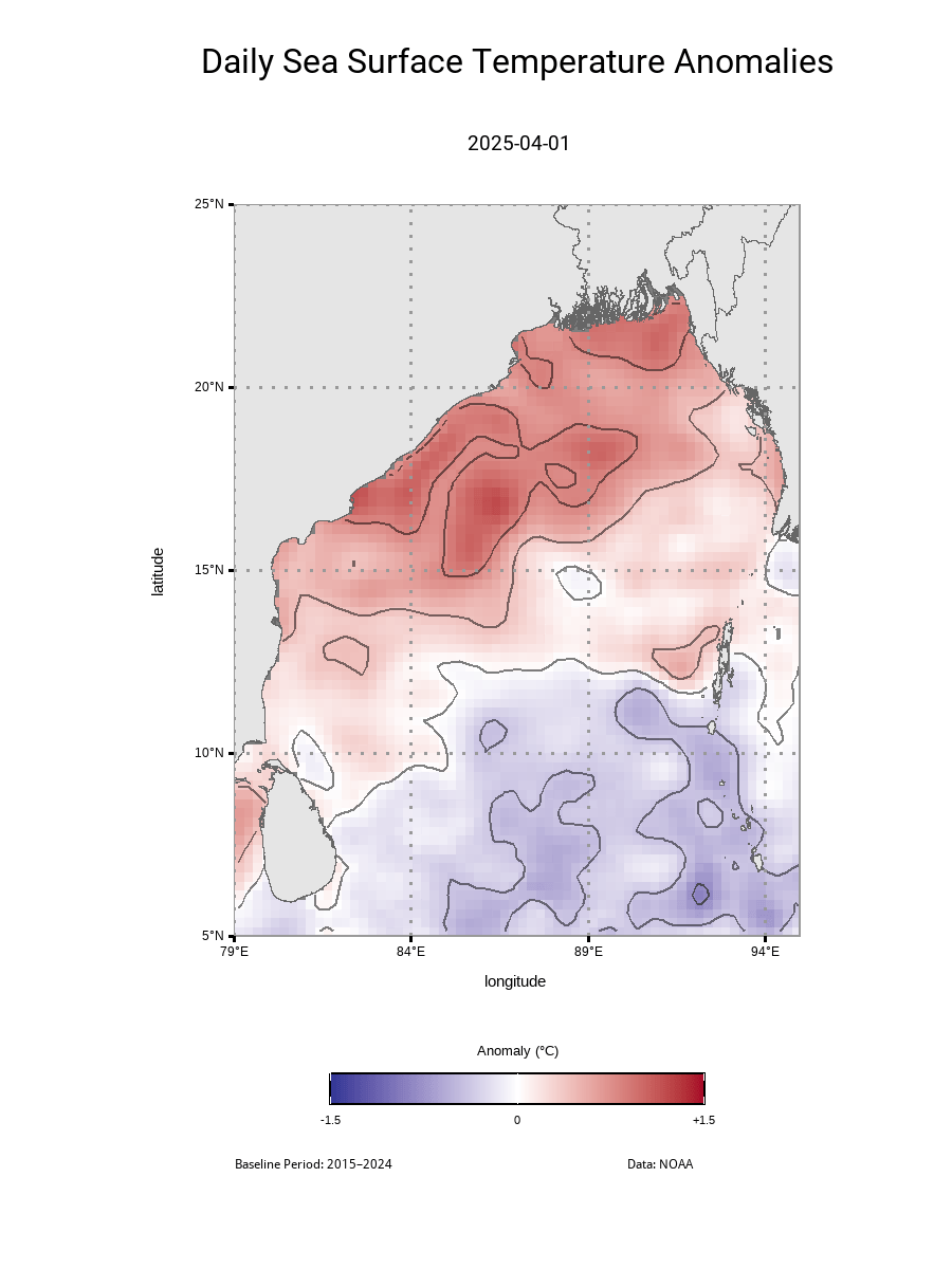
This SST anomaly map shows how much warmer or cooler the Bay of Bengal’s surface was in April 2025 compared to the long-term average (based on a 2015–2024 climatological baseline).
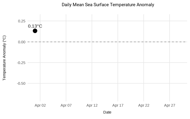
🌊 What happened in April 2025?
Using daily SST data from NOAA at 0.25° resolution, I calculated and visualized anomalies across the Bay of Bengal using R.
✅ April 1 started slightly warm: +0.13°C
📉 By April 12, anomalies dropped to -0.57°C
📆 From April 8–29, the ocean stayed consistently cooler than normal
📈 Mean Daily Anomalies ranged from+0.18°C → -0.57°C over the month.
🛠️ Tools: R programming
📡 Data: NOAA OISST
🗺️ Resolution: 0.25°